|
|
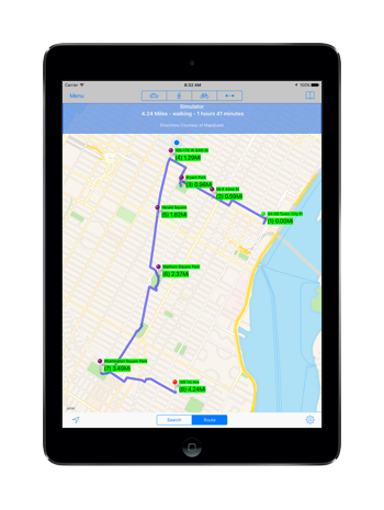
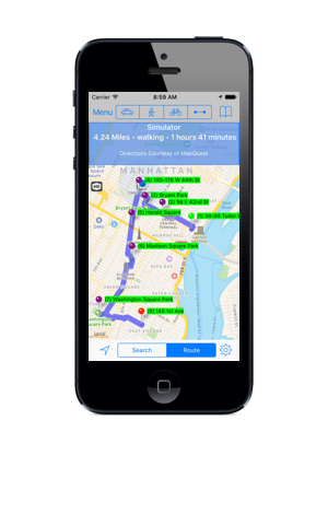
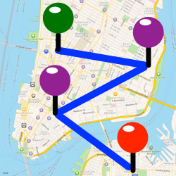
MapMyPlaces is a great tool for plotting on a map multiple locations. Add a location by simply touching the map, entering an address or search term in the search bar, or by selecting a location from your contacts or camera roll. Use this app to plan or record a itinerary or any other multi-stop tour or journey. Also use this app to display on a map and lookup the addresses of photos stored in your device’s camera roll. Optionally, you can add the Save & Email feature which enables you to save your locations as a group, and input/export group location data via email. Also, this option allows you to plot on a map all photos (including iCloud photos) on your device that have geolocation data. A Second option, is to add Routing, which will calculate and display driving, walking, cycling or point-to-point directions between up to 26 locations. MapMyPhotos is a companion app which displays the creation date, time, elevation and locations of photos on your device.
|

A
|
Features:
|
MapMyPlaces is a universal iOS app, it works the same way on an iPhone as on a iPhone.
|
MapMyPlaces on the iPad
|
MapMyPlaces on the iPhone
|